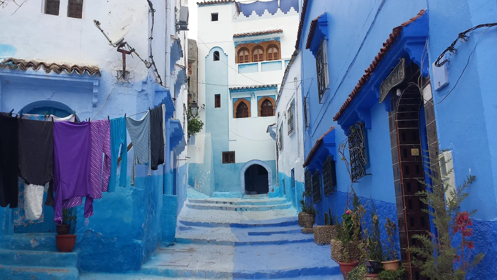
Chefchaouen and the Akchour Waterfalls by Car: the Blue City and the Gorges of the Rif
Chefchaouen, with its blue-painted lanes and houses clinging to the mountain, draws visitors from all over the world. With a car, you arrive at your own pace over the Rif roads, and the next day you can push on to the Akchour gorges, some thirty kilometres away, where group tours never leave you time to linger. Here is the route, where to park and what to plan for.
Photo: Allenfleming — CC BY-SA 4.0 (Wikimedia Commons)
Published on 18 March 2026
Contents
- Driving in from Tangier, Tetouan or Fez: the Rif in panorama
- Where to park in Chefchaouen, the blue city of Morocco
- The Akchour and God's Bridge day out: waterfalls and canyon
- Driving in the Rif: staying safe and relaxed
Driving in from Tangier, Tetouan or Fez: the Rif in panorama
Tangier and Tetouan are the closest starting points. From Tangier, allow about 110 kilometres on the N2, which runs through Tetouan and then climbs to Chefchaouen. The road is in good shape and well signposted: first the coastal plain, then a steady climb through valleys of pine and olive trees.
From Fez or Meknes to the south, the drive is longer: about 200 kilometres from Fez, via Ouezzane. The farmed hills of the pre-Rif roll by in long curves, and some winding stretches call for patience behind lorries.
Where to park in Chefchaouen, the blue city of Morocco
Chefchaouen's medina climbs the mountainside and can only be explored on foot. Drive into its lanes and you will end up in a dead end, with an awkward reverse to get out.
You have two options: park in the lower town near Bab Souk if your riad is down there, or at the top, by Ras El Maa on the east side of the medina, where a multi-storey car park has been built. In guarded car parks, the price depends on how long you stay and the season: ask before you leave the car, especially overnight.
The Akchour and God's Bridge day out: waterfalls and canyon
The car really earns its keep on day two. Akchour is about thirty kilometres from Chefchaouen, on the Oued Laou road, at the edge of Talassemtane National Park.
At the end of the road, leave the car in the car park, often guarded, and ask the price when you arrive. Two trails start there: one follows the river up to the big waterfall, between oleanders and wooden walkways, the other climbs to God's Bridge, a natural limestone arch over the canyon. Take proper shoes and water. Lunch is eaten with your feet in the water, on chairs set in the riverbed. The flow depends on the season: it peaks in spring and drops sharply in summer and after a dry winter. Ask before driving out for a swim.
Driving in the Rif: staying safe and relaxed
Some travellers worry about the Rif's reputation. On the main roads between Tetouan, Chefchaouen and Ouezzane, you drive among Moroccan families, and the Gendarmerie Royale is present.
Stick to the posted limits, which often drop on the way into villages, give a short toot before blind bends and switch on dipped beams when the morning mist settles on the ridges.
Frequently asked questions
What kind of car do I need for Chefchaouen and Akchour?
A small car is enough: the roads to Chefchaouen and to the start of the Akchour trails are paved. A compact SUV mainly adds comfort and a higher driving position on the climbs.
How long should I spend in Chefchaouen and the surrounding area?
Two days and two nights is a good pace: one day to wander and photograph the blue lanes of the medina, another to hike and picnic at Akchour.
Is fuel easy to find between Tangier and Chefchaouen?
Yes, there are service stations along the road to Chefchaouen. Still, fill up before heading out to Akchour.
Where is Chefchaouen, the blue city Morocco is famous for?
In the north of the country, in the Rif mountains. The town is about 65 kilometres south of Tetouan on the N2, the road that comes down from Tangier, 110 kilometres away. From Fez, allow about 200 kilometres via Ouezzane.
Why is Chefchaouen blue?
Nobody agrees on a single reason. The stories most often told link the blue to the Jewish families who once lived in the town, to a way of keeping insects away or the houses cool, or simply to the colour of the sky. Whatever the origin, walls and doorways are regularly repainted, and the blue lanes have become the town's signature.
Chefchaouen pronunciation: how do you say it, and why do people say Chaouen?
Say it roughly 'shef-sha-wen'. Many Moroccans simply call the town Chaouen. The full name is usually explained as 'look at the horns', after the two peaks that rise above the town.
What are the best things to do in Chefchaouen and its medina?
Wander the blue lanes of the medina on foot, early in the morning for photos, and walk up to Ras El Maa, on the east side, where the spring that feeds the town comes out. On day two, drive to Akchour, about thirty kilometres away, for the walk to the big waterfall or to God's Bridge. Park once, near Bab Souk or by Ras El Maa, and leave the car until you head out of town.
Fes to Chefchaouen or Rabat to Chefchaouen: which way do you drive?
From Fes, allow about 200 kilometres via Ouezzane, through the farmed hills of the pre-Rif, with winding stretches where you will wait behind lorries; Chefchaouen to Fes is the same road in reverse. From Rabat, you can stay on the motorway north towards Tangier and then take the N2 through Tetouan, or cut inland across the pre-Rif to Ouezzane, a shorter but more winding drive. Either way, plan to arrive in daylight.
Chefchaouen travel guide for December: what changes in winter?
December is winter in the Rif: the days are short, morning mist often settles on the ridges and the mountain roads can be wet, so drive in daylight and switch on dipped beams when the mist comes down. At Akchour, the flow of the river depends on the rains, so ask locally about the trails and the water before driving out.
Further reading
rent a car at Tangier Ibn Battouta airport
rent a car in Fez to drive up to the Rif
browse the SUVs available on Loccor
map of Morocco with cities and distances
Sources
Visit Morocco — visitmorocco.com
The Smart Choice in Morocco
Ready to Hit the Road in Morocco with Total Freedom?
Written by the Loccor editorial team, the platform connecting travellers with car rental agencies in Morocco.
Browse the cars available to rent in Tangier
Cars available to rent in Tangier
- Kia Picanto 2025
- · Dacia Sandero 2026
- · Hyundai i10 2026
- · Geely GX3 2026
- · Renault Kardian 2026
- · Renault Clio 2024
- · Peugeot 208 2025
- · Renault Clio 5 2026
- · Opel Corsa 2026
- · Dacia Logan 2026
- · Geely GX3 Pro 2026
- · Hyundai i20 2026
More articles from the guide
Why the Dacia rules Moroccan roads: a view from the ground
A Road Trip for Two in Morocco: 3 Romantic Escapes Behind the Wheel
Speed cameras, gendarmerie and road checks in Morocco: rules and fines
Petrol or Diesel in Morocco: Which Fuel Should You Pick for Your Rental Car?
The Agafay Desert in a Rental Car: an Escape on Marrakech's Doorstep, No 4x4 Needed
Driving at Night in Morocco: Why Caution Matters Off the Motorway